
Update:
What you need to know:
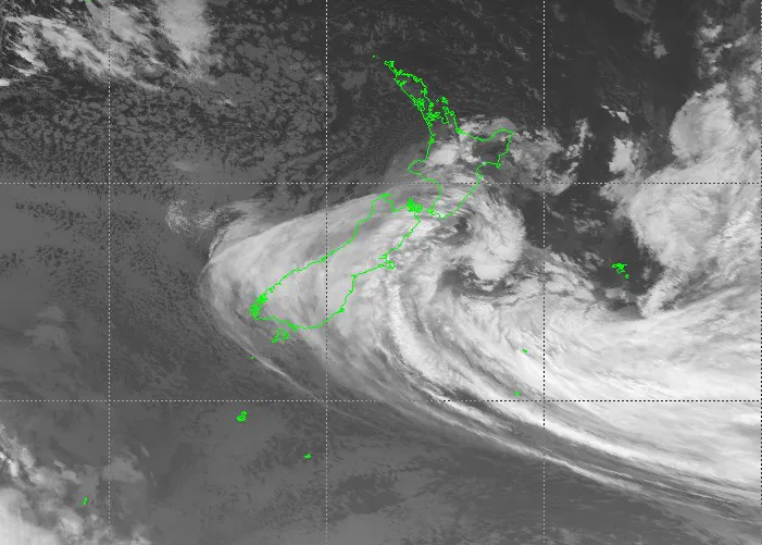
- Large parts of the country have been hammered by wild weather as torrential rain and gale-force winds set in for the next few days.
- A state of emergency was declared for Canterbury’s Selwyn District this morning due to heavy rain and rising river levels.
- Wellington’s wind warning has been upgraded to red as MetService warns of a “threat to life” from flying items and falling trees.
- Strong wind watches, heavy swell warnings and road snowfall warnings were also in effect across other parts of NZ.
- Flights to and from Wellington Airport have been cancelled, as have Cook Strait ferries.
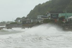
Wellingtonians are warned to stay inside and homes are without power as severe winds and heavy swells hit the capital, while in the South Island there is flooding and, in the Mackenzie District, snow.
On Thursday morning MetService upgraded its Wellington wind warning to red for the first time, reserved for the most severe weather events. The warning was in place from 10am on Thursday to 3am on Friday.
Wind speeds had reached at least 150kph in exceptionally exposed areas and 118kph elsewhere, and were expected to peak at 1pm with gusts up to 140kph possible, MetService said.
“We are advising people to stay indoors where possible and avoid unnecessary travel. If you need to travel this afternoon or evening, plan ahead as strong winds can make driving hazardous.”
People should not walk around outside or drive unless absolutely necessary and should bring pets indoors and move stock to shelter.He warned power cuts are possible in severe weather, advising people to unplug small appliances that might be affected by electrical power surges.
“If power is lost unplug major appliances to reduce the power surge and possible damage when power is restored.”
The Wellington Region Emergency Coordination Centre had been activated and was currently monitoring the situation in close contact with MetService, councils, lifeline utilities and emergency services.